Geosimulation
Geosimulation: combining simulation modelling in a (spatially explicit) map space.
Many of the interactive models used for projection over the 3D surfaces use geo-simulation models of landscape processes. One of the primary applications has been for the simulation of savanna fire behaviour to illustrate the key variables involved in fire management. Other projects have explored the control of weeds, feral animals and solar installation uptake.
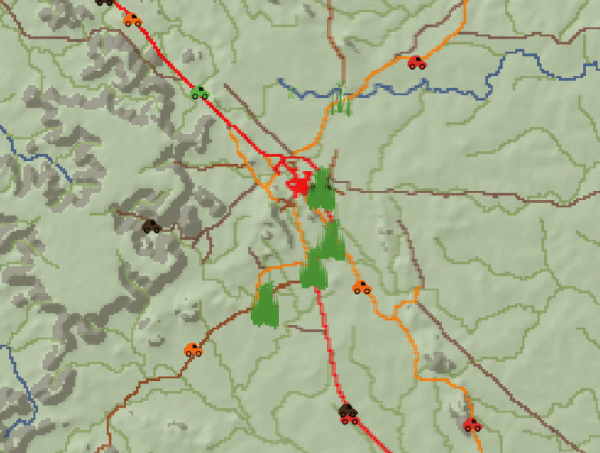
Savanna fire spread modelling - landscape-scale simulations.
Agent-based models of fire spread have been developed focusing on the fire management needs of northern Australia; these 'Incendiary' fire behaviour visualisation management models are not attempting to predict fire spread but rather provide a useful teaching and planning tool when thinking about fire management operations. The Incendiary models provide a virtual lab to explore fire management scenarios, to facilitate discussion between different land managers and across cultures and build common understandings related to key fire management issues in Northern Australia..
The Incendiary models aim to:
-
Facilitate the broader use of available fire-related data sets for understanding fire and ecosystems in Northern Australia
-
Allow this visualisation of fire behaviour in relation to a range of relevant landscape and fire weather variables. (ie fuel loads, fuel types, curing, wind speed, wind direction, temperature and humidity).
-
Support the communication of fire management objectives to a culturally diverse range of land managers.
More information about the model and application are here.
Fire and weeds - rural block (peri-urban)-scale simulations

Effectively engaging with landholders in rural/remote areas has traditionally been challenging due to
the Northern Territory’s sparsely populated rural landscape. This project is developed a bushfire
simulation tool designed to illustrate the impact on bushfire behaviour of different fire management
and bushfire mitigation actions.
Importantly, the system allows key fire intensity and fire protection parameters to be varied in order to illustrate bushfire risk and the effectiveness of mitigation measures.
The simulation was developed as an online Javascript game (https://go.cdu.edu.au/firesim) and has been used extensively by Bushfires N.T. and PFES for their community outreach program. This work included the development of the outreach video shown here.
Gamba Grass Spead Simulation
This project funded by Territory NRM’s Regional Landcare partnership project delivered two dynamic simulation models to illustrate Gamba Grass spread in the Top-End of the Northern Territory. Both models were designed to help describe challenges around Gamba Grass spread and control. The First Model explores gamba spread and management issues at a regional scale, the second extends some of the basic spread principles to simulate Gamba movement across the whole of the Top-End.
This simulation has been developed to describe the distribution and dynamics of feral buffalo herds on Melville island and to illustrate possible outcomes of an eradication program.
The tool aims to:
• Be understood by both land managers and the broader community.
• Show scenarios of possible outcomes related to buffalo management.
• Support clear communication about the potential impacts of the proposed feral buffalo eradication program.
The simulation is an 'agent-based-model' using spatially explicit raster data to moderate agent (buffalo) movent. The model is purely descriptive, designed to illustrate some of the key factors related to buffalo management. It is not intended to predict outcomes.
